Solutions
-
Enterprise Factory
Revolutionize manufacturing with smart factories and efficient production.
-
Cultural Heritage Tourism
Uncover history, embrace culture - unforgettable heritage journeys await.
-
Real Estate Sales
Dream homes, prime properties - find your perfect space.
-
Visual Arts
Ignite creativity, showcase masterpieces - where art comes alive.
-
Exhibition Hall
Stunning displays, immersive showcases - your story, our stage.
-
Commercial Retail
Shop, discover, indulge - a retail experience like no other.
-
Industrial Park
Prime spaces, endless opportunities - fuel your business growth.
-
Smart Home
Intelligent living, effortless comfort - the future of your home.
-
Art Space
Cloud-Borne Art Realm, A Walk Through Myriad Visions


Breaking the Deadlock in Real Estate Marketing! Capture Cloud's Low-Altitude Aerial 3D Real-Scene Navigation Brings House Viewing into the "3D Era"
When homebuyers are still troubled by "endless real estate projects and exhausting house-hunting trips," and when real estate enterprises are still struggling with "limited reach of offline exhibition halls and difficulty converting out-of-town customers," Capture Cloud uses low-altitude aerial 3D real-scene navigation technology to open a new door for real estate sales—
No more traffic jams or repeated appointments—just pick up your phone to "teleport" to any real estate project in the city, enjoy an immersive tour in high, medium, and low 3D spaces, and even host a live broadcast to take tens of thousands of people on a synchronized "cloud property tour"!
I. Tour All Urban Real Estate Projects in 3 Minutes? Capture Cloud Makes "Cross-District House Viewing" a Thing of the Past

What does this mean for real estate enterprises?
Out-of-town customers no longer need to travel long distances; they can complete "multi-property comparisons" online;
Salespeople don’t have to repeatedly show properties in the same area—they can use the system to demonstrate "cost-performance analysis of the same location" with one click;
During the opening period, customers can "tour" the real scenes of Phase I, II, and III simultaneously, accelerating decision-making efficiency.
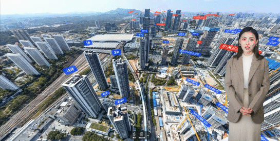
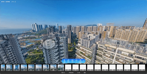
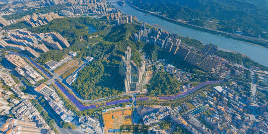
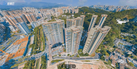
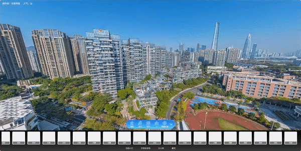
II. High-Medium-Low 3D Navigation: Not Just "Visible", but "Enterable"
Traditional aerial photography only offers "2D bird's-eye views", and VR house viewing is limited to "ground perspectives". However, Capture Cloud uses 3D spatial technology to give house viewing a "sense of hierarchy":
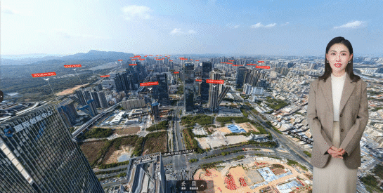
(High-Altitude Navigation)
High-Altitude Perspective: A bird's-eye view of the overall layout of the property, with building distribution, greening rate, and community circulation clearly visible at a glance—you can even see the straight-line distance to surrounding schools and business districts;
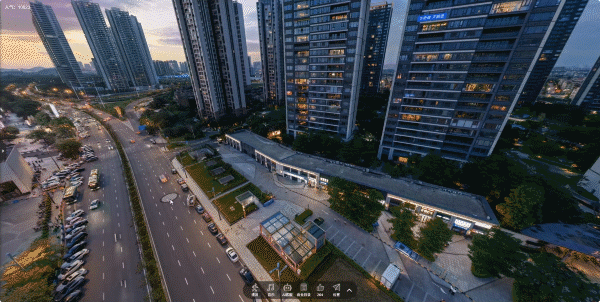
(Mid-Air Navigation)
Mid-Air Perspective: Fly around the buildings at low altitude to intuitively experience the building spacing, exterior wall materials, and window orientations—you can even "preview" the view from the balcony in advance;

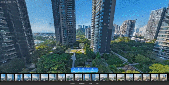
(Ground Perspective)
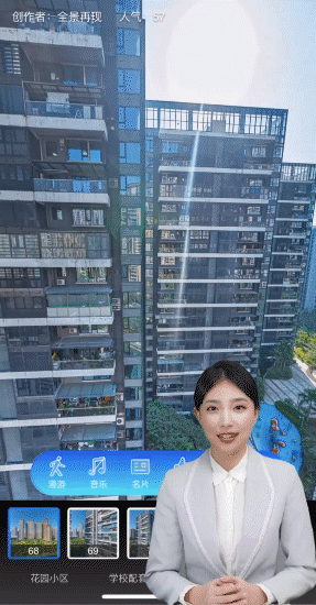
III. New Way of Live Streaming House Tours: Tens of Thousands of Viewers "Cloud Touring Properties" on the Same Screen with Explosive Interaction

(Live Broadcast: Tens of Thousands of Viewers "Cloud Touring Properties" on the Same Screen)
The host controls the navigation path: The camera switches freely between high-altitude, mid-air, and ground perspectives as the host explains. When the host says "Look at the east-facing balcony of Building 10", the screen flies to the corresponding location in real time, with tens of thousands of viewers focusing on the same detail simultaneously;
(Housing Surrounding Amenities)
A real estate enterprise used this technology for an "online opening live broadcast", which attracted over 50,000 viewers in a single session—30% of whom were out-of-town customers—and locked in more than 200 groups of intentions on the spot. Live broadcasts are no longer "one-way output", but an immersive experience of "ten thousand people touring together".
IV. Why Capture Cloud? The "Real Estate DNA" Behind the Technology
The reason why Capture Cloud's 3D real-scene navigation can accurately meet house-purchasing needs lies in its core principle of "technology serving marketing":
99% Real-Scene Restoration: 8K-level low-altitude aerial photography equipment is used to present even the stone texture of walls and the types of vegetation in gardens in high definition, avoiding the trust crisis caused by "discrepancies between renderings and real scenes";
Data Integration Capability: During navigation, users can directly connect with sales consultants, book offline house tours, and save "favorite housing notes", realizing a closed loop of the entire "view-inquire-book" process.
V. From "Exhausting Trips" to "Cloud Navigation": Real Estate Marketing Is Being Reconstructed
For homebuyers, this is a "revolution in house-viewing efficiency"—completing the house-viewing volume that used to take 3 days in just 1 hour, with more comprehensive comparisons and more rational decision-making;

Now, open the Capture Cloud 3D Real-Scene Navigation System—which property are you ready to "tour in the cloud"? Click the QR code below to unlock the 3D navigation access for urban properties and experience the futuristic feeling of "viewing houses while sitting" in advance↓

(Click to Experience 3D Property Navigation)
Other News
-
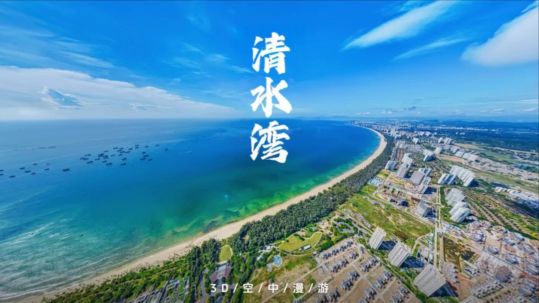
Stunning Launch! 3D Aerial Tour of Hainan Qingshui Bay, Unlocking a New Vision of the City
-
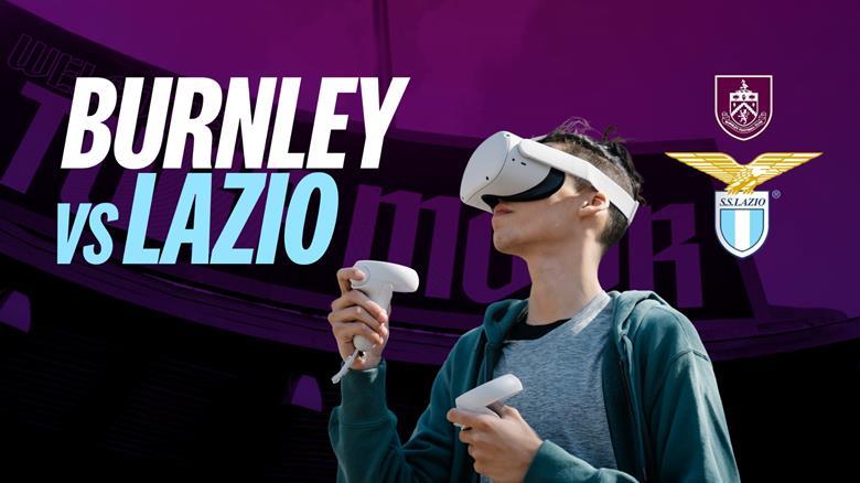
Burnley Football Club will host its first VR live stream
-
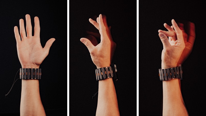
Meta has updated its research on sEMG wristband for input, published in Nature.